Record size tornadoes strike U.S.
Satellite imagery reveals vast swathes of destruction
Major tornadoes hit the U.S. Midwest and South, leaving a trail of casualties and destruction. Using satellite images of the damage and cloud movements, Nikkei tracked the intensity of, in the words of what President Joe Biden called “one of the largest” tornado outbreaks in U.S. history.
A candle factory is devastaed.
Slide the bar left and right to compare before and after images of the affected areas.
A satellite image of the area around a candle factory in Mayfield, Kentucky, on Jan. 28, 2017 (left) and an image of the same area on Dec. 11, after the tornadoes passed through (right). The roof is gone and the entire building appears to have been swept away.
(©2021 Maxar Technologies, Reuters)
A nursing home is also badly hit.
Slide the bar left and right to compare before and after images of the affected areas.
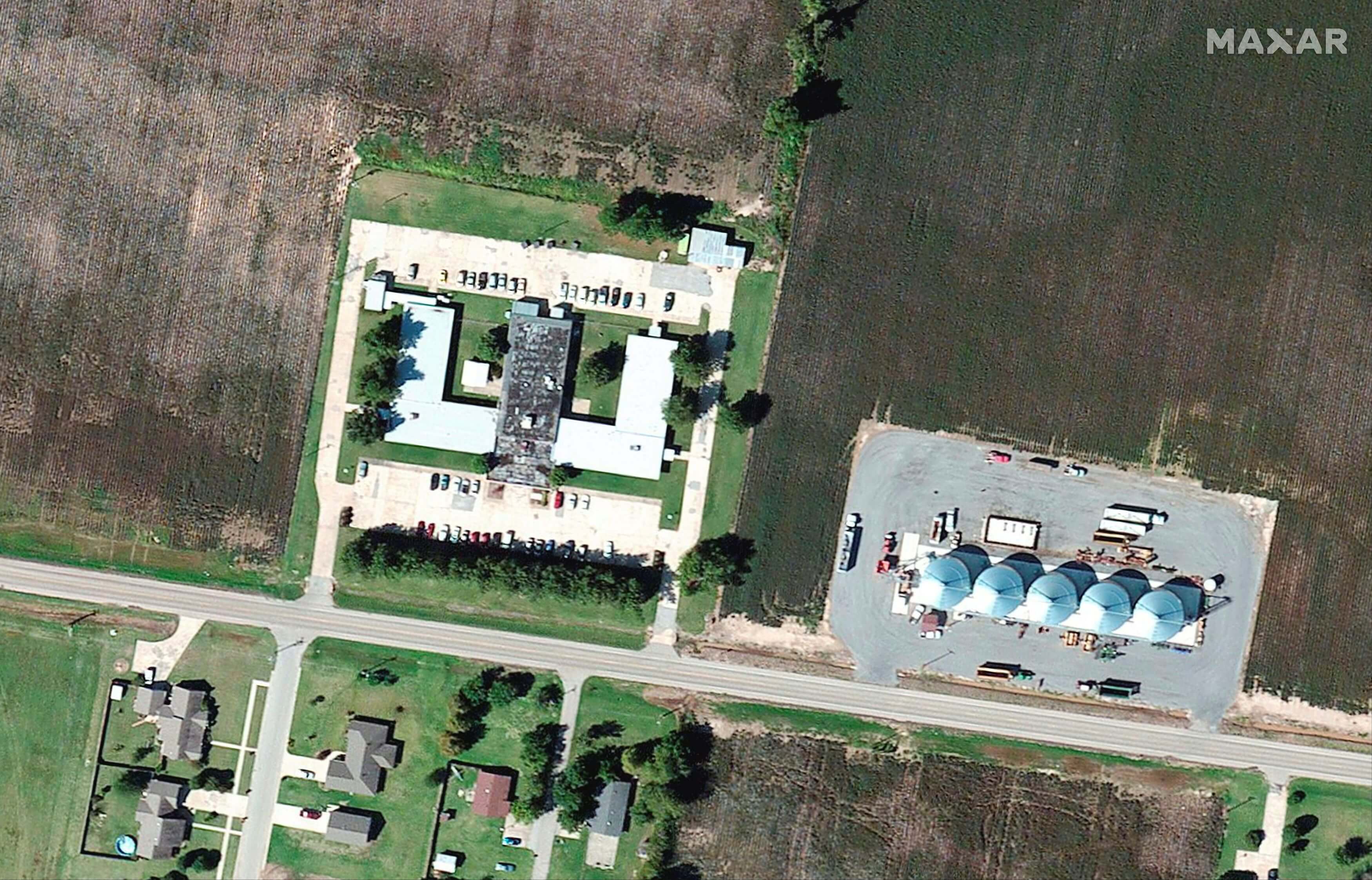
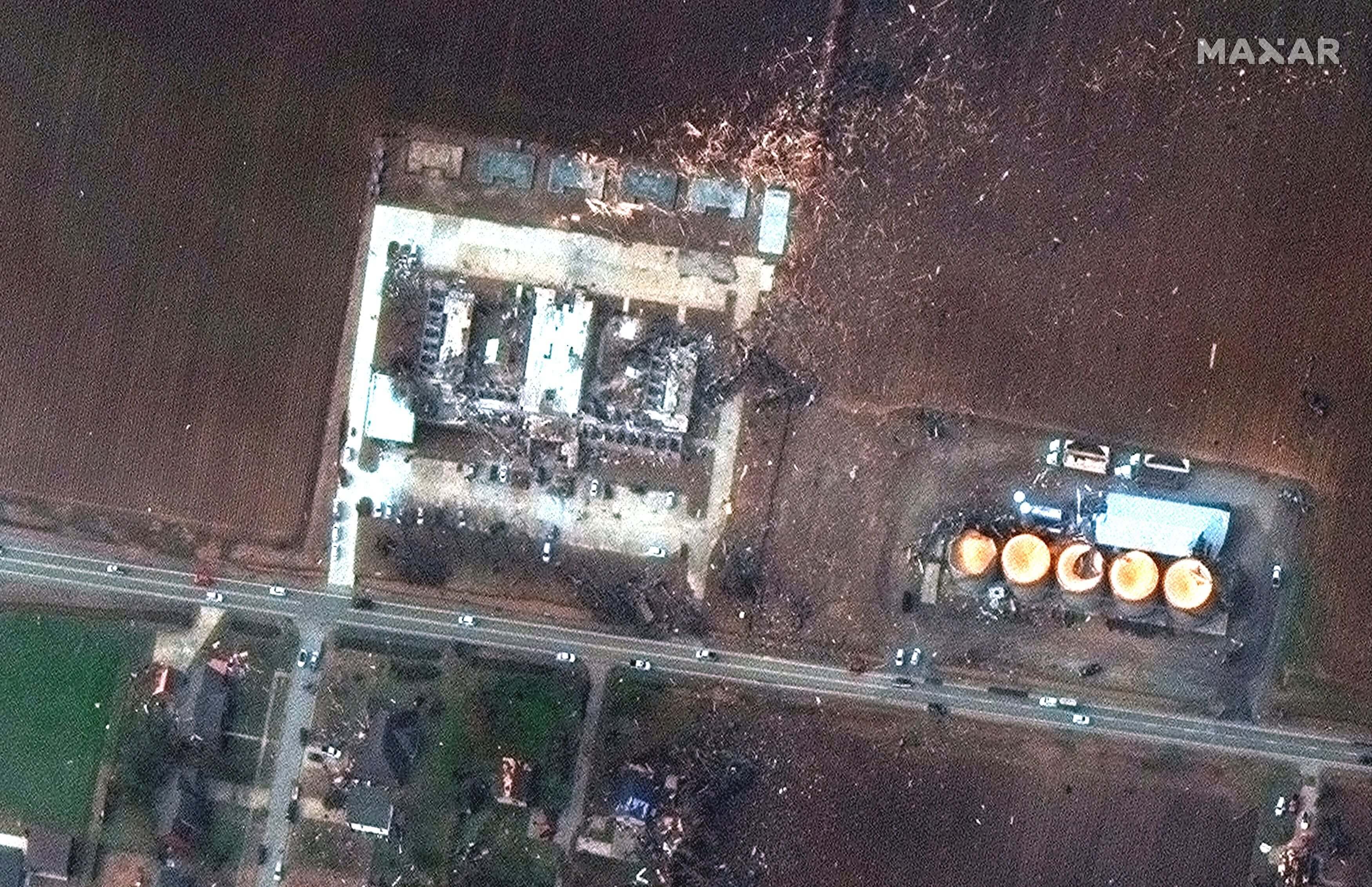
A satellite image of the area around a nursing home in Monette, Arkansas, on Feb. 22 (left), and an image of the same area on Dec. 11 (right). Materials appear to be scattered around the building.
(©2021 Maxar Technologies, Reuters)
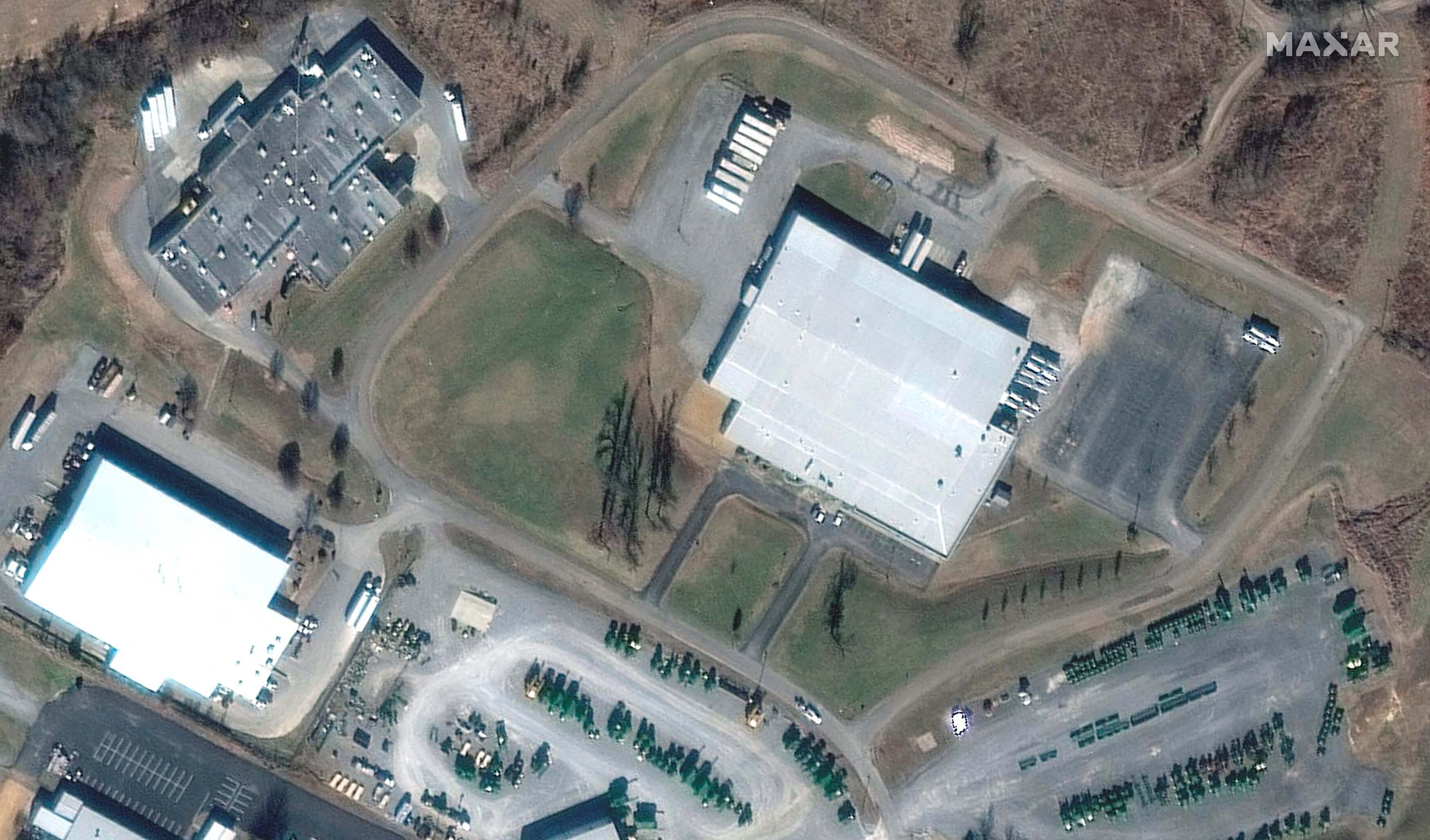
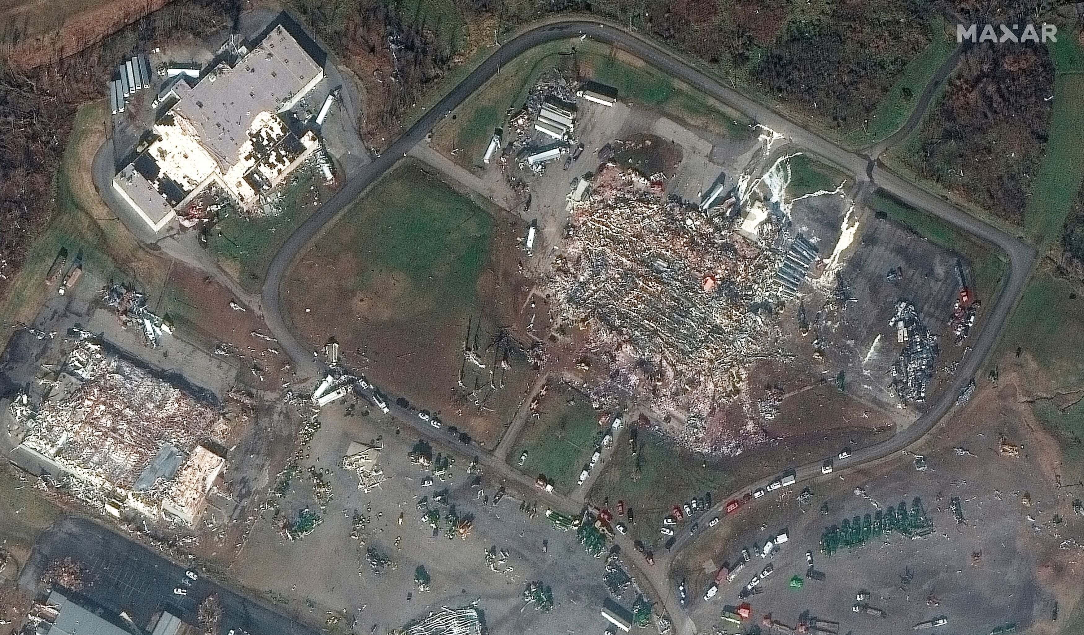
The roof of an Amazon warehouse is torn off.
Slide the bar left and right to compare before and after images of the affected areas.
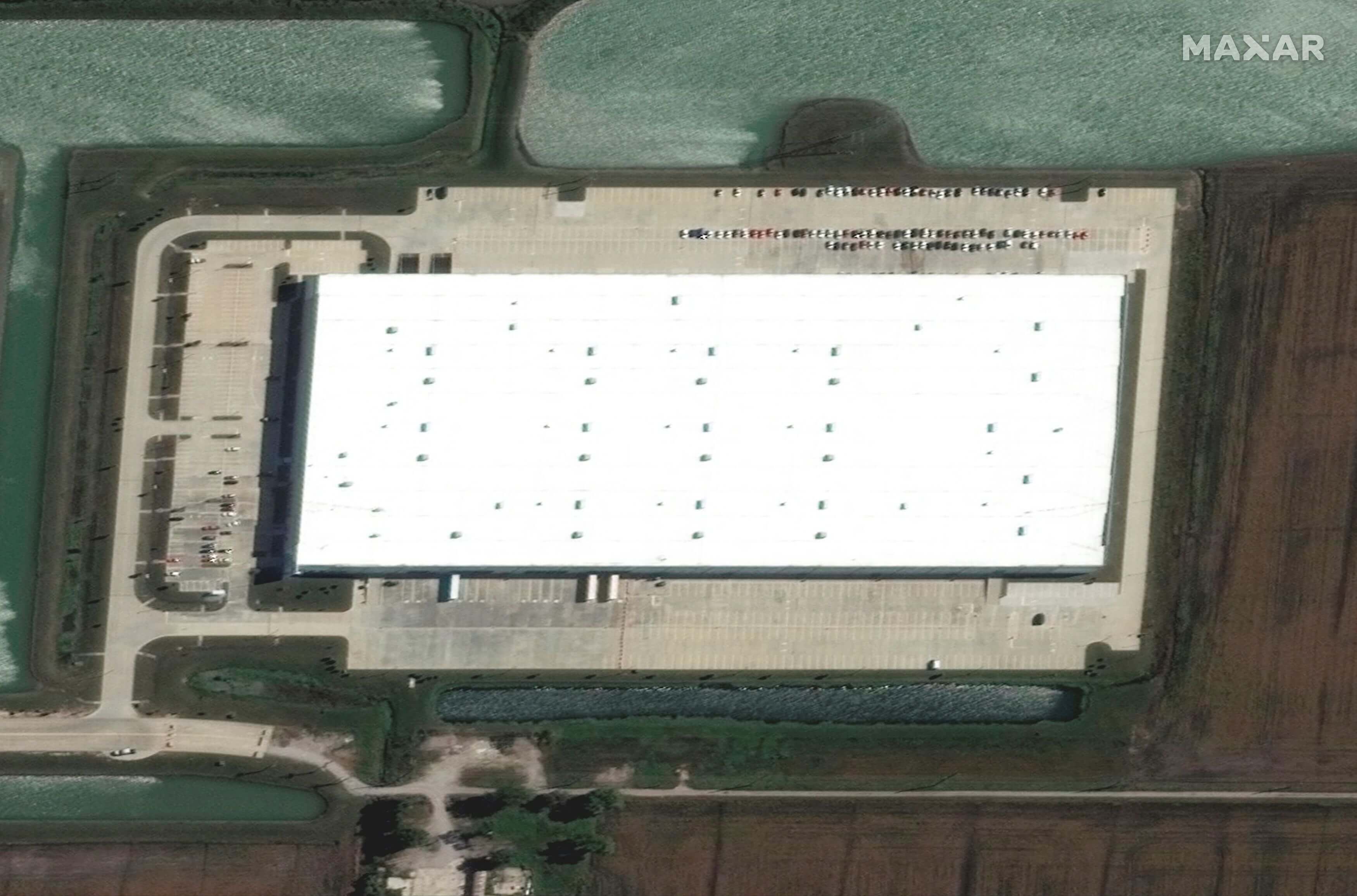
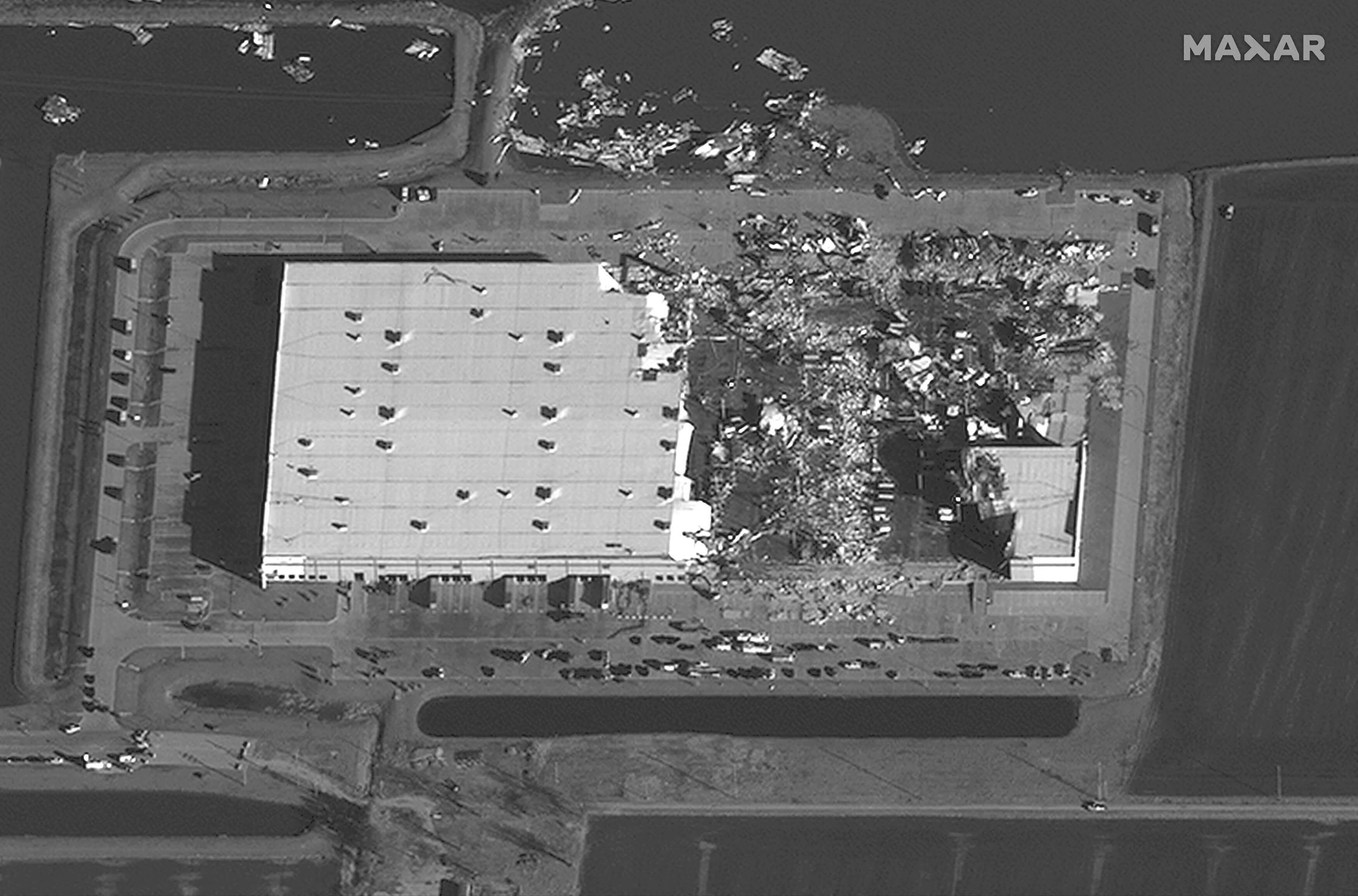
A satellite image of Amazon’s warehouse in Edwardsville, Illinois, on Sept. 24 (left), and Dec. 11. Half of the roof is gone and the building looks as if it has been gouged out.
(©2021 Maxar Technologies, Reuters)
The streetscape of this residential area is completely changed.
Slide the bar left and right to compare before and after images of the affected areas.
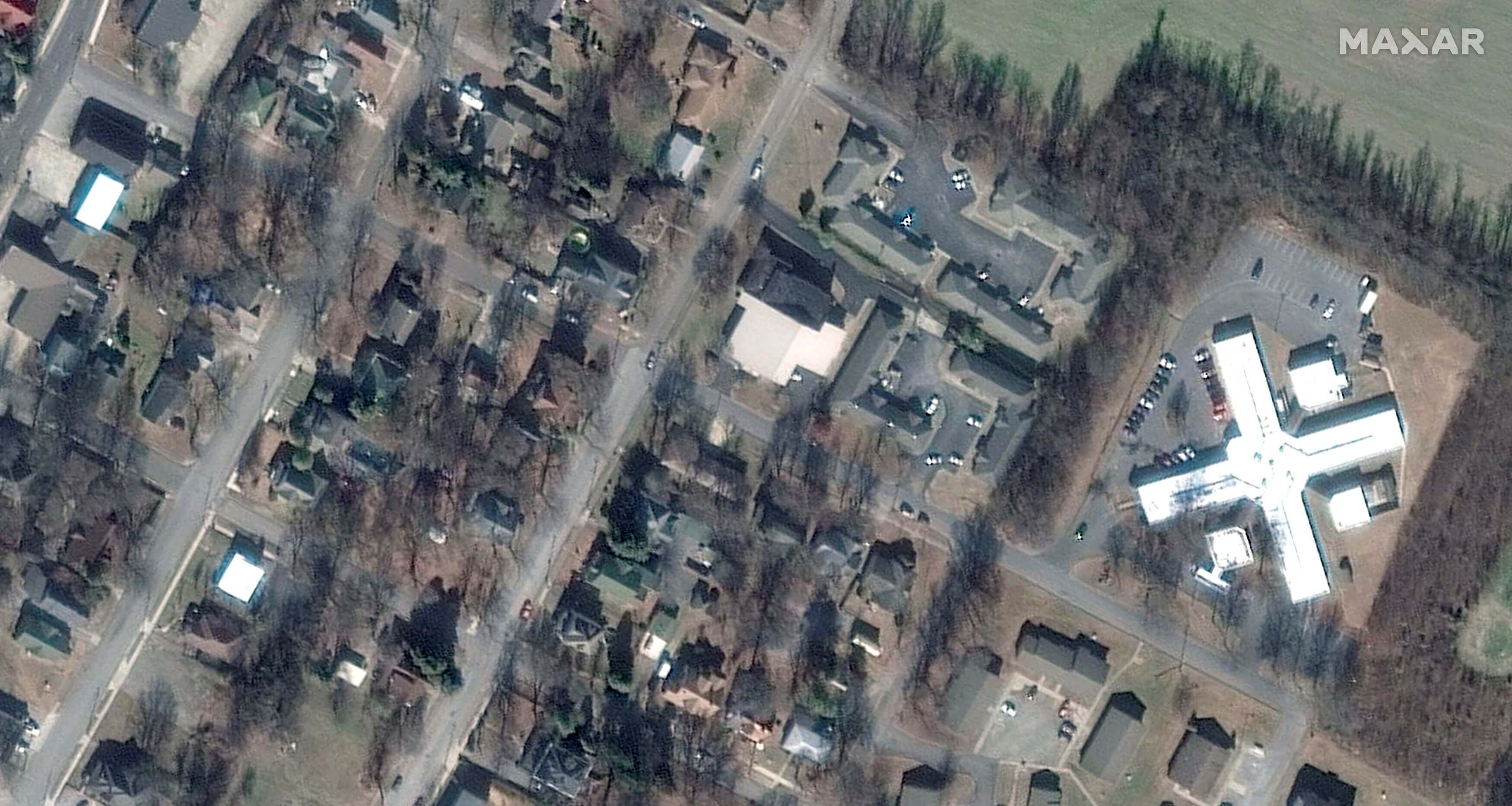
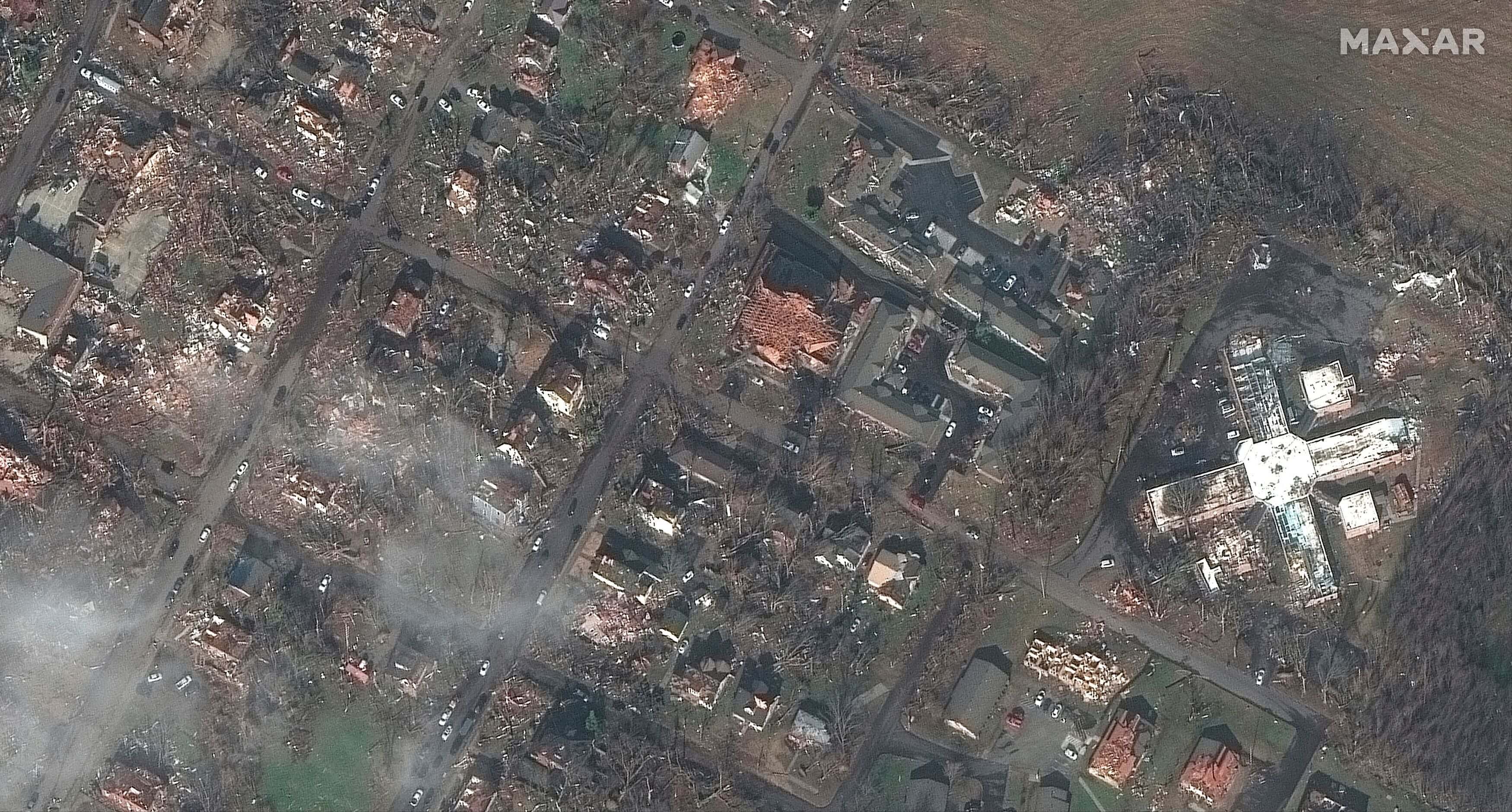
A residential area of Mayfield, Kentucky, taken on Jan. 28, 2017 (left), and a satellite image of the same area on Dec. 11. Many homes were destroyed, leaving behind a devastated townscape.
(©2021 Maxar Technologies, Reuters)
Over 50 tornadoes blow through nine states.

According to the U.S. National Weather Service, at least 50 tornadoes were confirmed across nine states. A dense band of tornadoes was confirmed across the states of Arkansas, Missouri, Tennessee and Kentucky, which likely indicates a giant cumulonimbus “supercell” that spawned twisters as it moved northeast. The flat regions of the Great Plains stretch from the Rocky Mountains in the west to the Appalachian Mountains in the east. Cold air from the north and warm air from the south collide here unobstructed, making the atmosphere unstable. That leads to frequent tornadoes and has given the area the nickname “tornado alley.”
The tornado moved from southwest to northeast
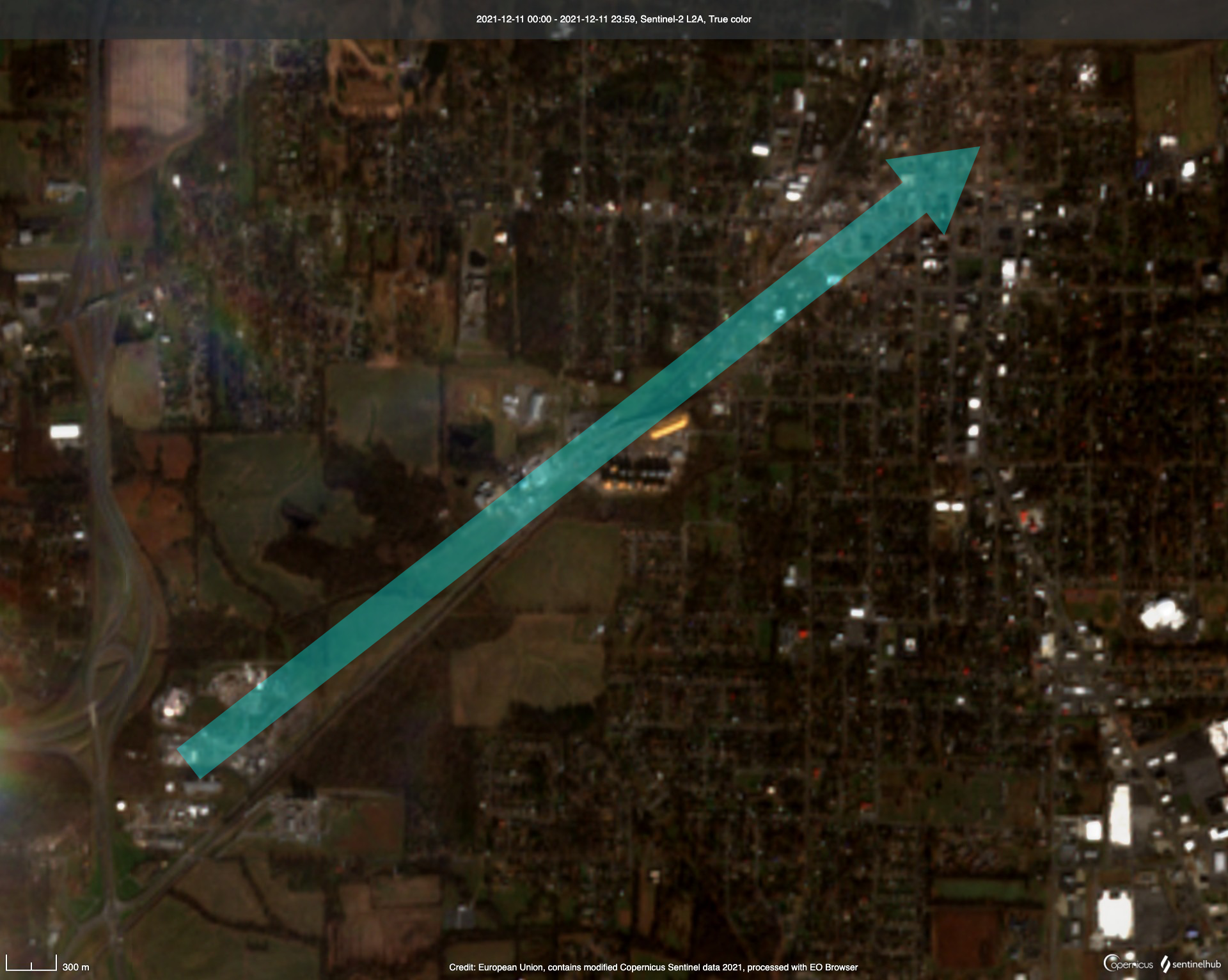
In Mayfield, Kentucky, a candle factory collapsed, causing major damage in the city. Tornado vortexes often spin counterclockwise, according to Hiroshi Niino, professor emeritus of meteorology at the University of Tokyo, meaning debris is strewn to the left of their paths. Satellite photographs of downtown Mayfield indicate the tornado likely moved from southwest to northeast. According to the U.S. National Weather Service, the maximum windspeed of the confirmed tornadoes in Kentucky was 70 to 90 meters per second. It is thought that some of the tornadoes were equivalent to a 5, the highest rating on the “Enhanced Fujita Scale” (EF0-5), which indicates the strength of a tornado. Experts will conduct detailed surveys to determine the extent of the damage.
A series of supercells formed, setting off a string of deadly tornadoes.
“The weather conditions were typical for a tornado outbreak,” said Niino. Water temperatures Gulf of Mexico remained higher than usual, blanketing the southern U.S. with warm air. From the night of Dec. 10 to the morning of Dec. 11, cold air flowed in from the northwest, colliding with this warm air and causing atmospheric instability in the South and Midwest. A series of supercells formed along the boundary between the warm and cold air, creating spiraling updrafts, or tornadoes, beneath them. In the U.S., tornadoes occur most often in May and June. They are less common in December. “The unusually high temperatures in the South led to this tornado outbreak,” said Niino.
The alert was raised day by day.
Dec. 8, level two
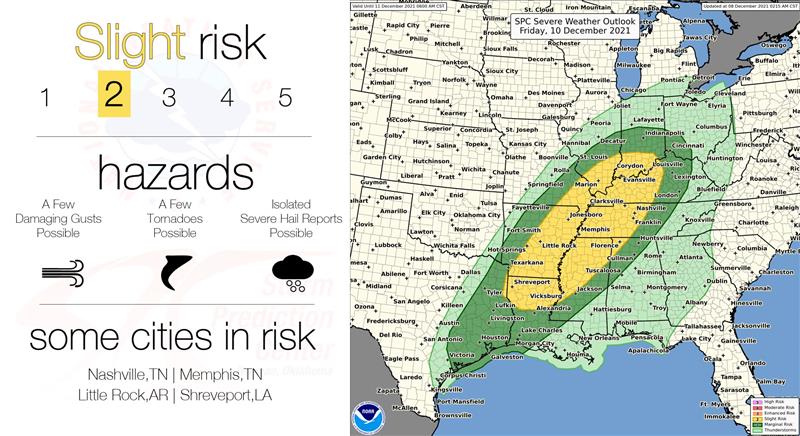
Reviewing information from the National Weather Service Storm Prediction Center, the initial forecasts for the possibility of a tornado were being raised each day. A tornado watch was issued for areas in Mississippi and Tennessee on Dec. 8. Initially it was a “level two” out of a potential five, and officials warned of the possibility of several tornadoes.
Dec. 9, level three
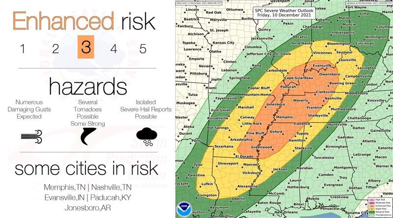
On Dec. 9, the alert was raised to “level three,” the level at which several strong tornadoes are possible.
Dec. 10, level four
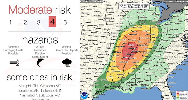
After that, the warning was issued multiple times until Dec. 10, when the tornadoes occurred, and the affected area grew. Finally, the warning was raised to level four, the second highest.